
Changbai Mountain
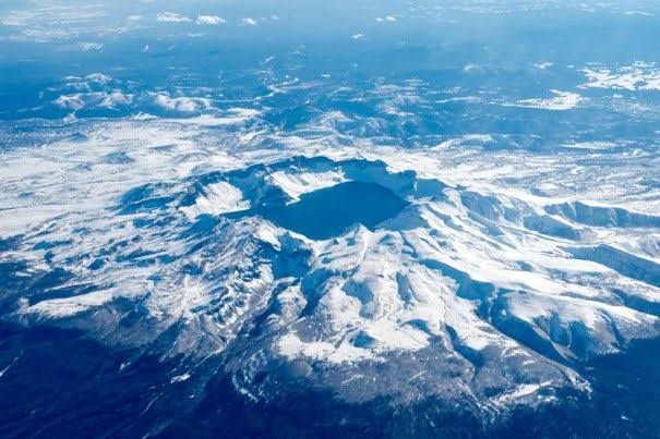
Changbai Mountain, Golmin Šanggiyan Alin in Manchu and known on the Korean Peninsula as Paektu, became the border mountain between China and North Korea after the 1962 boundary treaty. In the broad sense it is a range running southwest to northeast for more than a thousand kilometres through eastern Jilin, Liaoning and Heilongjiang and across Ryanggang in North Korea; in the narrow sense it is its main peak, Baitou or General's Peak, at about 2,749 m, the highest point in Northeast China and on the Korean Peninsula. It is a dormant volcano that has erupted many times, and a vast eruption around the tenth century is counted among the largest of the past two thousand years. Its summit caldera holds Heaven Lake, the deepest lake in China and the source of the Songhua, Tumen and Yalu rivers. The mountain's complete vertical vegetation zones led to its protection as a nature reserve in 1960 and its joining the UNESCO Man and the Biosphere network in 1980.
- Region
- Jilin, China · Ryanggang, DPRK
- Model area
- ≈ 639 km²