Kilimanjaro 3D Terrain Model
Africa's highest peak at 5895 m, a free-standing stratovolcano in Tanzania. Export Kilimanjaro as a printable STL, OBJ, DAE or Rhino 3DM file for free.
- Coverage
- Kilimanjaro, Tanzania
- Coordinates
- 3.08°S 37.37°E
- Model area
- ≈ 533 km²
- Formats
- STL · OBJ · DAE · 3DM
- Resolution
- 30 m
© OpenFreeMap · © OpenStreetMap
About this place
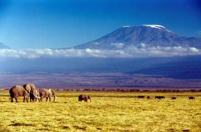
Kilimanjaro is a dormant stratovolcano in north-eastern Tanzania, close to the Kenyan border, and the highest mountain in Africa at 5,895 m above sea level. It is also the highest free-standing mountain on Earth, rising from the surrounding plains without belonging to a larger range. The massif is built from three cones: Kibo, the highest, crowned by Uhuru Peak; the jagged Mawenzi; and the lower, older Shira. Its broad, gently sloped summit supports one of the few equatorial glaciers, now retreating rapidly. Climbing Kilimanjaro passes through five ecological zones, from cultivated foothills and montane rainforest through heath, moorland and alpine desert to the arctic summit. Protected as Kilimanjaro National Park in 1973 and inscribed as a UNESCO World Heritage Site in 1987, it is climbed by tens of thousands of trekkers each year.
How to use
For hiking & outdoor
Use the 3D view to read ridgelines, relief and the overall shape of the terrain before a trip. It is a static elevation model for reference only; it is not live navigation, routing or safety guidance.
For 3D printing
Download the model as STL, OBJ, DAE or Rhino 3DM and open it in your slicer or CAD tool. Files carry terrain geometry only; printability, scale and mesh quality depend on how you slice them and are not guaranteed here.