Mount Fuji 3D Terrain Model
Japan's highest peak at 3776 m, a near-perfect stratovolcano. Export Mount Fuji as a printable STL, OBJ, DAE or Rhino 3DM file for free.
- Coverage
- Honshu, Japan
- Coordinates
- 35.36°N 138.74°E
- Model area
- ≈ 308 km²
- Formats
- STL · OBJ · DAE · 3DM
- Resolution
- 30 m
© OpenFreeMap · © OpenStreetMap
About this place
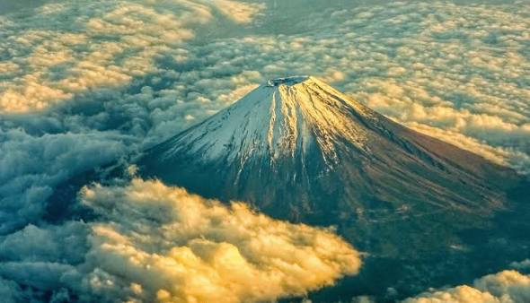
Mount Fuji is the highest mountain in Japan, a stratovolcano on the island of Honshu rising to 3,776 m astride the border between Shizuoka and Yamanashi prefectures, about 100 km south-west of Tokyo. Its almost perfectly symmetrical cone is the country's most recognisable natural landmark and a long-standing subject of art and pilgrimage, celebrated in Hokusai's Thirty-six Views of Mount Fuji. It last erupted in 1707 during the Hoei era and is still classified as an active volcano under close monitoring. In 2013 UNESCO inscribed it as a World Heritage cultural site, 'Fujisan, sacred place and source of artistic inspiration', recognising both the mountain and the shrines, pilgrimage routes and lakes around it. The official climbing season runs from early July to early September, when hundreds of thousands reach the summit.
How to use
For hiking & outdoor
Use the 3D view to read ridgelines, relief and the overall shape of the terrain before a trip. It is a static elevation model for reference only; it is not live navigation, routing or safety guidance.
For 3D printing
Download the model as STL, OBJ, DAE or Rhino 3DM and open it in your slicer or CAD tool. Files carry terrain geometry only; printability, scale and mesh quality depend on how you slice them and are not guaranteed here.