Grand Canyon National Park 3D Terrain Model
The Grand Canyon in northern Arizona, carved by the Colorado River. Export it as a printable STL, OBJ, DAE or Rhino 3DM file for free.
- Coverage
- Arizona, USA
- Coordinates
- 36.44°N 111.86°W
- Model area
- ≈ 296 km²
- Formats
- STL · OBJ · DAE · 3DM
- Resolution
- 30 m
© OpenFreeMap · © OpenStreetMap
About this place
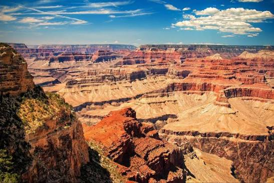
Grand Canyon National Park lies in northern Arizona, USA, where the Colorado River has carved one of the most spectacular gorges on Earth. About 446 km long and up to more than 1,800 m deep, the canyon exposes nearly two billion years of geological history in its layered red rock walls. Designated a national park in 1919 and a UNESCO World Heritage Site in 1979, it is traditionally the homeland of the Havasupai, Hualapai and other Native American peoples. Visitors gather along the South Rim and the more remote North Rim to take in its immense scale and shifting colors.
How to use
For hiking & outdoor
Use the 3D view to read ridgelines, relief and the overall shape of the terrain before a trip. It is a static elevation model for reference only; it is not live navigation, routing or safety guidance.
For 3D printing
Download the model as STL, OBJ, DAE or Rhino 3DM and open it in your slicer or CAD tool. Files carry terrain geometry only; printability, scale and mesh quality depend on how you slice them and are not guaranteed here.