Yosemite National Park 3D Terrain Model
Glacier-carved granite landscape in California's Sierra Nevada. Export Yosemite National Park as a printable STL, OBJ, DAE or Rhino 3DM file for free.
- Coverage
- California, USA
- Coordinates
- 37.73°N 119.60°W
- Model area
- ≈ 183 km²
- Formats
- STL · OBJ · DAE · 3DM
- Resolution
- 30 m
© OpenFreeMap · © OpenStreetMap
About this place
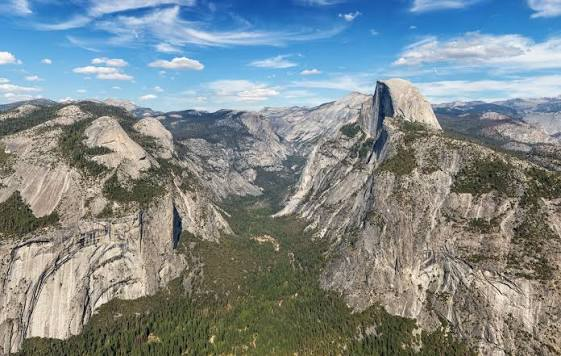
Yosemite National Park lies in the central Sierra Nevada of California, USA, about 300 km east of San Francisco. Established in 1890, it covers roughly 3,000 km² of glacier-carved granite landscape and was inscribed as a UNESCO World Heritage Site in 1984. Its most celebrated features are the sheer granite walls of El Capitan and Half Dome, the towering Yosemite Falls — among the highest in North America — and groves of giant sequoias. The park's dramatic valley, sculpted by ancient glaciers, has drawn visitors, climbers and photographers since the 19th century and helped inspire the modern conservation movement.
How to use
For hiking & outdoor
Use the 3D view to read ridgelines, relief and the overall shape of the terrain before a trip. It is a static elevation model for reference only; it is not live navigation, routing or safety guidance.
For 3D printing
Download the model as STL, OBJ, DAE or Rhino 3DM and open it in your slicer or CAD tool. Files carry terrain geometry only; printability, scale and mesh quality depend on how you slice them and are not guaranteed here.